Did you know that a railroad once ran through the Highlands property?
See Remnants on our (challenging) Swift Creek Hiking Trail!
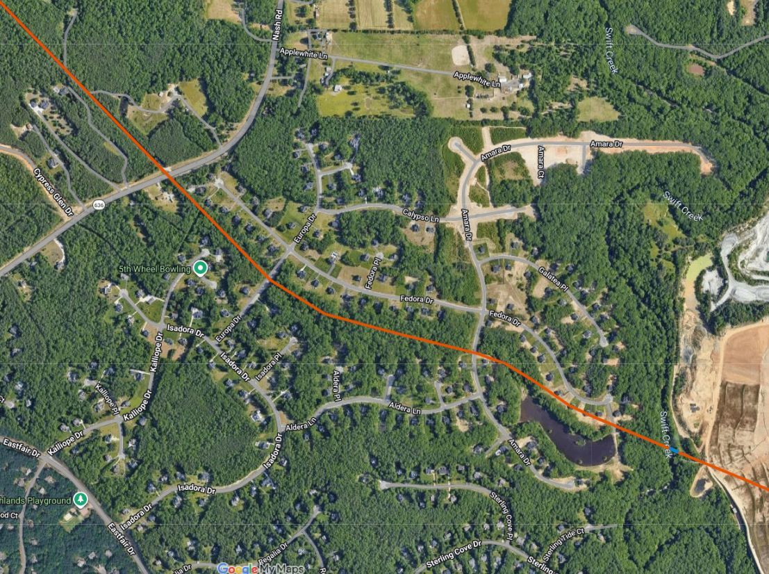
The county water pumphouse outside our development on Nash Road utilizes a straight-line path originally used by railroad tracks. – Wow!
The RR originally ran through this path, along a path parallel to Fedora Dr., and across Swift Creek. The abutments from the Swift Creek Rail Bridge can still be seen from the (newly improved) Highlands Swift Creek Hiking Trail.
The Railroad (RR) Background:
In 1847, the Clover Hill Mining Company built 18 miles (29 km) of railroad to transport coal from the coal mines at Winterpock to the town of Chester for further RR transport to Bermuda Hundred. This new line ran along Beach Rd, through the Highlands, across Swift Creek, along Carver Heights Dr. (behind the Walmart), into Chester.
This RR later (1877) became the Bright Hope Railway, and later still (1889), the Farmville and Powhatan Railroad. The line survived until 1917 when it was pulled up and sent to France for the World War I effort.
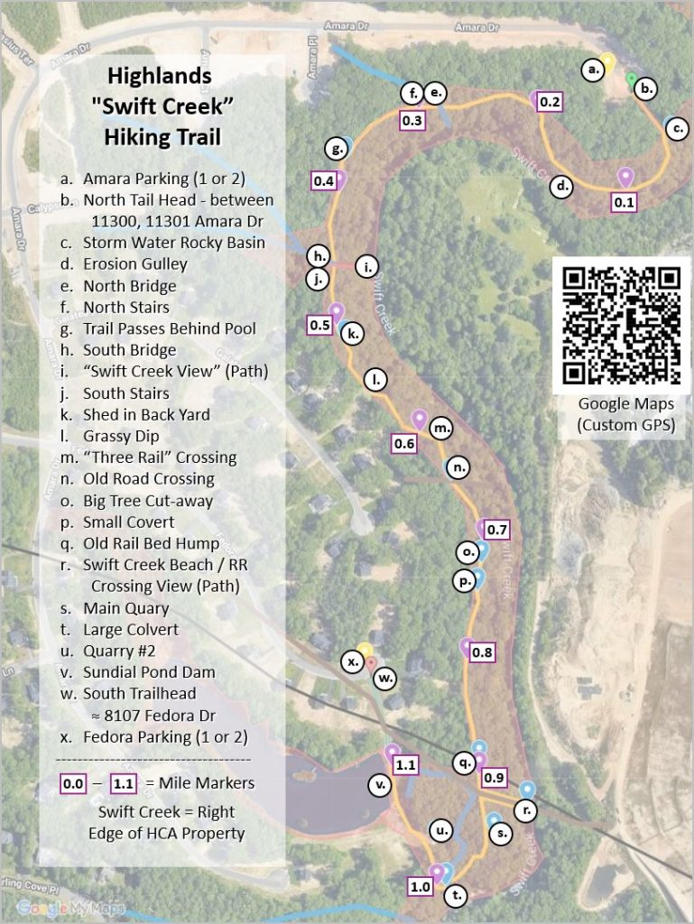
Highlands Swift Creek Hiking Trail
This is NOT the Nature Trail!
The HCA (our neighborhood) owns a challenging Hiking Trail (NOT or Nature Trail) along the Swift Creek river. It is located on the eastern side of the Highlands “Sundial Farms” neighborhood.
A primary feature is a view of the abutments of the Swift Creel RR Crossing.
The trail has recently gone through an improvement by volunteers from the Lakes & Trails Committee and is ready for (relatively) easy use by our community.
Information is on our page for our Swift Creek Hiking Trail.